Tuesday, March 29, 2022

Safety Fail: Lack of Zebra Crossings on ECG in Ogletown

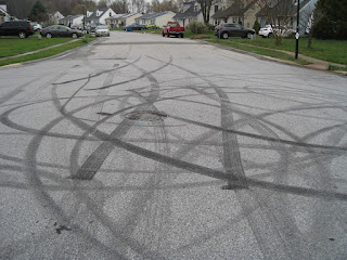
Seriously eroded ECG used for car parking
Cross-posted from Ogletown Resilience

With the approval of a Historical Marker commemorating Ogletown, and a quarter millennia  since the passing of its founder, the time has come to improve multi-modal access to this historic site. Regional legislators, including Senator Jack Walsh, have already agreed on action to address the failed infrastructure surrounding Thomas Ogle's tomb and green space. This includes the East Coast Greenway (ECG) west from SR273, and two connectors: one to Prides Crossing and the other to Chestnut Hill Estates via Old Ogletown Rd.

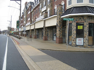
More recently, we discovered the gross lack of zebra striping of the ECG (streetview) through Chestnut Hill Plaza, a Meineke repair shop, and a Liberty gas station. Meinekie has even adopted the ROW as defacto car parking. This facility was originally paved at the width (8') required for bidirectional bike-ped traffic, and is eroded and narrowing in many sections. It rises up and back down through driveways, when the opposite is required for traffic calming and multi-modal awareness. Adding zebra crossings won't fix the problem of high speed entrances from SR4, but will bring awareness (and thus some added safety) for ECG users and Ogletown destination-making.

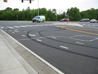
ECG just west of Augusta Drive
We were rebuffed in an effort to improve the Augusta Drive intersection further west. Instead, ECG continuity was broken, with a new, cars-only signal upgrade. Further west, driveways at the DE School for the Deaf (DSD) are properly aligned and zebra striped, as seen in the photo right. It would appear that Complete Streets is being applied sporadically, or by socio-economic status, with consequences that could take decades to fix.

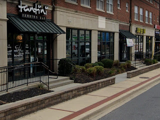
The long range goal for the ECG is a continuous facility brought up to modern design standards, some of which can be found further to the east. Recent setbacks like Augusta, however, only cement Ogletown among the disenfranchised. When asked, there are few to no answers from several oversight orgs. In contrast, Advocates should be pouncing on each and every opportunity to improve the ECG -- even with basic highway maintenance projects as called for in DelDOT's Complete Streets policy.


This proposal
to enhance placemaking in Ogletown would bring some consolation -- not just for Thomas Ogle but also the loss of the Orphanage Property as a regional park -- the chance of which will never come again.

Thursday, March 3, 2022

Delaware on track to smash 2021 crash fatals

First 2 months of 2022. Multi-year sampling periods confirm the
trend we are on. Click on image above for the latest numbers.
Statistically, Delaware is heading for a road safety disaster in 2022 - in particular New Castle County. Speeding, aggressive and distracted driving is rampant, with per-capita injuries and fatalities on pace to surpass even Florida. Despite strict laws to the contrary, many (if not most) offenders have a State-approved aftermarket and/or modified exhaust system. These behaviors account for why virtually nobody rides a bicycle for transportation or recreation -- even after 10 years of Complete Streets policy implementations.

There is virtually no pro-active law enforcement, particularly within Delaware's vast unincorporated zones. Police are few and far between, and spend most of their time answering 911 calls. An active and growing minority of drivers know this, as evidenced by the many vehicles now sporting fully tinted windows (also illegal). Even the City of Newark won't enforce the most deafening and disturbing of "loud mufflers". The lack of such basic government services has Delaware ranking criminally awful (CFPI), especially in matters of transparency. It is a top-5 worst State to live on several key socio-economic fronts, and consistently ranks as most dangerous to walk or ride a bicycle .

Mean Streets: designing cars like Dearth Vader
Our safety and quality of life is being destroyed right in front of our eyes; vehicle assault and violence is deafening our ears and ruining our health. County and State legislators offer token support, sometimes introducing bills that build on existing laws -- but these come up woefully short on enforcement. Organizations that claim to advocate for bicycling and connectivity have either given up on road safety or appear to be co-opted.

Minus a paradigm shift, and a mass conscience re-awakening toward the common good, things are only going to get worse. The suburbs, which comprises the vast majority of Delaware's built environment, are "entropy made visible", and will not be rescued unless we collectively change our thinking.

The above assaults are becoming more and more prevalent, even on Delaware's "quieter" neighborhood streets. We are trying to obtain 911 call data, that shows that this is among the most frequent emergency call types in New Castle County (stay tuned).


Above: "Bike Lane" on Red Mill Road in Ogletown. Authorities often question as to why so few people ride in Delaware, yet the answer is laid in rubber for all to see.

Wednesday, January 26, 2022

DelDOT: W11-1-DE Signs Restored on Paper Mill Rd

The W11-1-DE signs were removed from Paper Mill Rd at the White Clay Creek road bridge in Newark, upon the installation of a new pedestrian bridge. This sent the wrong message to car drivers that bicyclists are required to use this new bridge to circumvent the road bridge. We requested that the W11-1-DE signs be re-installed since bicyclists are legally permitted and will continue to use the road and its bike lanes. Failure to do so will result in drivers harassing bicyclists, given the new bridge is in plain sight.

Image courtesy of the Public Workshop
While this new bridge is a valuable amenity, the apparent switch to mandatory-use for bicyclists is problematic for 2 reasons:
  • It requires two crossings of 2 lanes of high VMT traffic in the northbound direction of Paper Mill Rd, which is statistically more dangerous, and more time consuming, and
  • Much of the pathway between the new bridge and Curtis Mill Park is 5' wide and not the min. 8' required to be safe. Therefore, it does not qualify as a bi-directional facility (this alone makes it ped-only) according to DelDOT's manual (pdf)

In this current config, the new bridge and its connecting pathways and crosswalks are not a suitable replacement for experienced bicyclists. DelDOT immediately responded, and re-installed the W11-1-DE signs on Mon Jan 24, and for that we are grateful.

Given how many people (esp students) ride the sidewalk now, it would certainly help if there was the required 8' asphalt SUP connected from the Old Paper Mill Rd crosswalk to the Pomeroy Trail. Regardless, we should never remove bicycling safety infra (in this case signage and sharrows) from the road. You can still see the signs in Streetview HERE.

Original W11-1-DE sign at Paper Mill Rd bridge southbound
With us backing him, Mark Luszcz (DelDOT Chief Traffic P.E. at the time) did a lot of work to get these signs approved and out there. This resulted in the removal of hundreds of "Share the Road" signs, replacing a mere fraction with W11-1-DE in strategic locations. This includes pinch points like the Paper Mill Rd road bridge. It was a big contribution in the reduction of sign clutter. It was also -- tho' not officially -- a compromise with P.E.s who don't like "Bicycles May Use Full Lane", because that sign (R4-11) preceded this one at this bridge and it was switched out unannounced.

Even if there is a project someday to connect 8' of asphalt between the Curtis Mill Park and the Pomeroy Trail, there are still bike lanes on Paper Mill Rd, so the signs should remain -- now more than ever actually. Kudos to DelDOT for listening, and answering the call of safety.

Wednesday, January 5, 2022

The Failure of Newark's South Main Street

S. Main Street facing South, median section

Why has Newark's "New" South Main Street failed to capture the cultural and historic richness that every U.S. Main Street should enjoy? Why hasn't it lived up to the civic and place-making ambiance (albeit eroded) of the City's East Main Street?

Writer and journalist James Howard Kunstler demonstrates the failure of modern U.S. architecture and civic design in this 19 minute TED Talk. The failure of South Main Street begins at 9:22, or HERE, and could not be more apparent.


Unfortunately, such reckless design continues in development and "revitalization" projects today. It remains to be seen if, for example, College Square is truly walkable & bikeable. Odds are, it will be the usual hellscape designed to encourage everyone to drive, and to park as many cars as possible. Place-making and multi-modal provisions, if included, are an afterthought at best. But maybe we'll be lucky, and College Square will be an improvement. You can read about it HERE.

Architecture is but one component failure of South Main Street. This "street" was designed with a mix of highway (12'+ wide) car lanes, numerous high speed slip (turn-only lanes) and even a 18' center turn lane for a portion of it. Traffic calming is all but absent except in the area of Amstel Ave, for the sake of University of Delaware foot traffic. Beyond that, induced motorist speed is much higher than the posted 30 mph, which in a true Main Street environment would be 25 mph or less. Sadly, South Main Street is little more than a "Stroad". Stephen Lee Davis points out the failure of this design in his brilliant piece HERE:

Slip lanes on roads and streets are emblematic of what it looks like in practice to sacrifice safety on the altar of speed, where this underlying goal of “keep cars moving fast at all times” runs counter to the goal of “keep everyone safe while moving from A to B”—even if you say that safety is important. If we truly prioritize safety, as T4America is suggesting in our second principle, we would never build a slip lane on a local street again.

Conclusion: S. Main Street planners ignored good civic design by combining separated and/or raised retail frontage with speed-inducing highway design. They hoped it would appeal at the human scale, but even in the early planning phase of this project 15 years ago, this was a known fail (note: JHK's TED Talk is from 2004).  Marginal sidewalks and bike lanes alone cannot replace traffic calming and facilitate a return to the public realm. Because of this, foot traffic on South Main Street is a fraction of East Main Street, and many (if not most) storefronts remain vacant for years, some occupied by UD or the developers themselves. Unfortunately, this built environment is built and baked in for many years to come.

Divorce complete: The relationship between retail, the sidewalk and street is destroyed upon separation.

Tuesday, January 4, 2022

Abandoned Roads in NCC: Old Harmony

Old Harmony Road was replaced by Harmony Road, a 2-lane arterial with wide shoulders. Fragments of Old Harmony can still be found, including the original bridge over the White Clay Creek. For those with a keen eye, this historic structure is still visible from "New" Harmony Road.

The below stretch between Brookhaven, Green Valley and Richardson's Garden Center serves today as a defacto linear park and non-motorized travel connector. There are no apparent plans to improve upon this wonderful place-making opportunity. It is quite likely that DelDOT owns the property, and that someday the bridge will be demolished. Worse yet, the corridor will be developed or reclaimed as a bypass road. Let's hope that is not the case, and that the community or a non-profit advocacy org will fight for its protection for future generations to enjoy.

Photos below are from June of 2018; it remains virtually unchanged today. At bottom is Google Streetview, to the best location to walk, bike or park your car to begin this trip back in time.


See our entire series on abandoned roads and railroads, in Delaware and beyond, HERE.